21st May, 2020 12:00
Fine Photographica & Instruments of Science


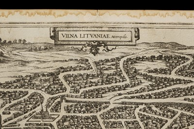
A 16th Century Map of Vilnius, Lithuania
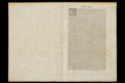
A 16th Century Map of Vilnius, Lithuania, A 16th Century Map of Vilnius, Lithuania, Braun & Hogenberg, 1599, map title ‘VILNA LITVANIAE’ uncoloured, 53cm x 42cm Note: from first latin edition of Volume III, plate 59, of “Civitates orbis terrarum,” drawn 1576, possibly based on an image by the Flemish artist, Guillebert de Lannoy, who visited Vilna in 1414
Sold for £1,004
Result including buyers premium
A 16th Century Map of Vilnius, Lithuania, A 16th Century Map of Vilnius, Lithuania, Braun & Hogenberg, 1599, map title ‘VILNA LITVANIAE’ uncoloured, 53cm x 42cm Note: from first latin edition of Volume III, plate 59, of “Civitates orbis terrarum,” drawn 1576, possibly based on an image by the Flemish artist, Guillebert de Lannoy, who visited Vilna in 1414
Auction: Fine Photographica & Instruments of Science, 21st May, 2020

