9th Sep, 2021 12:00
Books, Photographs & Works on Paper

Bacon, George Washington, 123 Numbered maps c.1880
Bacon, George Washington [1831 - 1922], 123 Numbered maps C.1880, A comprehensive collection of maps numbered 1-122 covering most of the globe, some maps printed as single sheets with others split over several sheets, maps include:
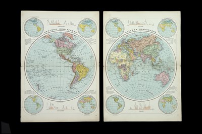
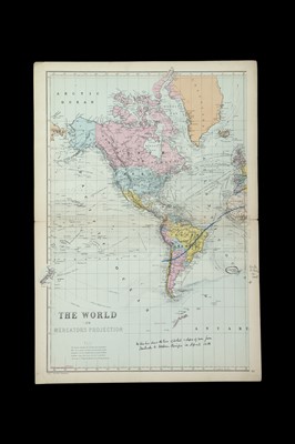
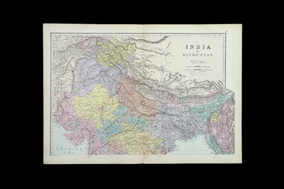
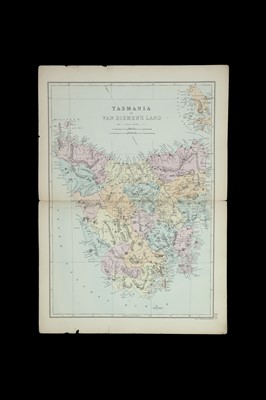
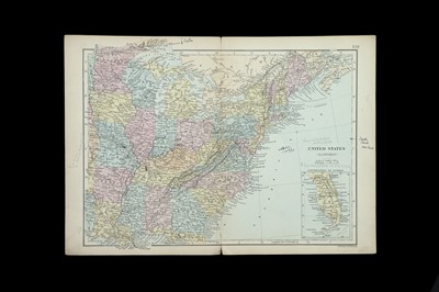
Western Hemisphere, Eastern Himisphere, The world on Mercators Projection (two Double Sheets, some pen marks), Europe ( pen marks), central europ ( writing and marks denoting ‘Prohibited zone in 1914), British Isles, (pencil markings to margin), England & Wales(four Double Sheets), Scotland (four Double Sheets), Shetland Islands, Ireland (four Double Sheets), Ireland (four Double Sheets), Channel Islands, France Belgium & Switzerland, France (Six Double Sheets), Belgium, Switzerland (two Double Sheets), Spain and Portugal (four Double Sheets, pen marks and pasted label), German Empire & Holand, German Empire (four Double Sheets), Holland, Denmark, ( Double Sheets writing on map), Norway Sweden & Denmark, Sweden & Norway (two Double Sheets pen to margin), Iceland, Russia in Europe, Russia In Europe (four Double Sheets), Austria, Austria-Hungary (four Double Sheets), Turkey in Europe, Turkey in Europe and Greece (four Double Sheets), Italy, Italy North, Italy - Lombardy & Venice, Italy - Emilia, Tuscany Umbria & Rome, Italy - Ambruzzo, Apulia, Campania & Basilicata, Italy – Calbria & Sicily, Corsica & Sardinia, The Caucasus and Armenia, Map of the Mediterranean and adjacent countries shewing the submarine telegraph cables, and lengths of principle steam routes, Asia and North -East Africa (pen and pencil notes to margins), Central Asia, Turkey in Asia, Asia Minor, Palestine (two Sheets), Arabia, Persia, Afghanistan & Baluchistan, India, China, Japan, East Indies, Sumatra, Africa, Egypt (single and double sheets), Morocco, Algeria & Tunis, South Africa, North America, United States Eastern (pen and pencil notes) Dominion of Canada and North America (two Double Sheets), Ontario, Quebeck, Jamaica & Hayti, Cuba & Jamaica, Leeward & Windward Islands, South America (two Double Sheets), Guiana – British, Dutch & French, Australia, New South Wales & Victoria, Western Australia & South Australia, Queensland, Victoria, New South Wales, New Zeland, New Zealand North Island, New Zealand South Island,
Bacon, George Washington [1831 - 1922], 123 Numbered maps C.1880, A comprehensive collection of maps numbered 1-122 covering most of the globe, some maps printed as single sheets with others split over several sheets, maps include:
Western Hemisphere, Eastern Himisphere, The world on Mercators Projection (two Double Sheets, some pen marks), Europe ( pen marks), central europ ( writing and marks denoting ‘Prohibited zone in 1914), British Isles, (pencil markings to margin), England & Wales(four Double Sheets), Scotland (four Double Sheets), Shetland Islands, Ireland (four Double Sheets), Ireland (four Double Sheets), Channel Islands, France Belgium & Switzerland, France (Six Double Sheets), Belgium, Switzerland (two Double Sheets), Spain and Portugal (four Double Sheets, pen marks and pasted label), German Empire & Holand, German Empire (four Double Sheets), Holland, Denmark, ( Double Sheets writing on map), Norway Sweden & Denmark, Sweden & Norway (two Double Sheets pen to margin), Iceland, Russia in Europe, Russia In Europe (four Double Sheets), Austria, Austria-Hungary (four Double Sheets), Turkey in Europe, Turkey in Europe and Greece (four Double Sheets), Italy, Italy North, Italy - Lombardy & Venice, Italy - Emilia, Tuscany Umbria & Rome, Italy - Ambruzzo, Apulia, Campania & Basilicata, Italy – Calbria & Sicily, Corsica & Sardinia, The Caucasus and Armenia, Map of the Mediterranean and adjacent countries shewing the submarine telegraph cables, and lengths of principle steam routes, Asia and North -East Africa (pen and pencil notes to margins), Central Asia, Turkey in Asia, Asia Minor, Palestine (two Sheets), Arabia, Persia, Afghanistan & Baluchistan, India, China, Japan, East Indies, Sumatra, Africa, Egypt (single and double sheets), Morocco, Algeria & Tunis, South Africa, North America, United States Eastern (pen and pencil notes) Dominion of Canada and North America (two Double Sheets), Ontario, Quebeck, Jamaica & Hayti, Cuba & Jamaica, Leeward & Windward Islands, South America (two Double Sheets), Guiana – British, Dutch & French, Australia, New South Wales & Victoria, Western Australia & South Australia, Queensland, Victoria, New South Wales, New Zeland, New Zealand North Island, New Zealand South Island,
Auction: Books, Photographs & Works on Paper, 9th Sep, 2021
Viewing
By appointment only
Thursday 2nd September 11.00am - 5.00pm
Friday 3rd September 11.00am - 5.00pm
Saturday 4th September 12.00am - 4.00pm
Monday 6th September 11.00am - 5.00pm
Tuesday 7th September 11.00am - 5.00pm
Wednesday 8th September 11.00am - 4.00pm
No viewing on sale day, online, telephone and commission bidding only

